Who Built It—and Why Is It There?
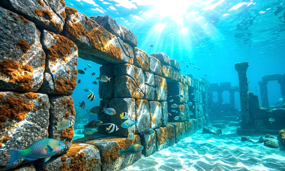
It was first spotted in 2017, not by a diver or a sonar scan, but by a retired geologist analyzing depth charts on his computer. A strange, unnatural line on the seafloor off the coast of Brittany, France. It took seven more years—and a series of diving missions—to confirm what it was. A massive stone wall, built by human hands 7,000 years ago, now sitting nine meters beneath the Atlantic.
The wall stretches 120 meters (about 394 feet) long, stands up to two meters (6.5 feet) high, and weighs an estimated 3,300 tonnes. It’s the largest underwater structure ever found in French waters. And it’s forcing archaeologists to rethink what they thought they knew about Stone Age coastal societies.
The Discovery: A “Very Interesting” Anomaly
The story begins with Yves Fouquet, a retired geologist living on the Île de Sein, a small island off Brittany’s western tip. In 2017, while reviewing high-resolution laser depth charts of the seabed, he noticed something that didn’t make geological sense: a perfectly straight, unnatural alignment of stones at a depth of about nine meters.
“I spotted structures that, to me, were not geologically coherent,” Fouquet explained. He alerted the Society for Archaeology and Maritime Memory (SAMM), a local diving group. Between 2022 and 2024, divers explored the site, and what they found confirmed Fouquet’s suspicion: dozens of megaliths—large stone blocks—fitted vertically into the bedrock, with smaller stones and slabs packed around them to form a continuous wall.
“Under the algae, they saw several dozen megaliths, installed there for at least 7,000 years,” Fouquet said. The presence of these large, deliberately placed standing stones was the revelation. “It revealed the anthropogenic character—built by man—of this wall”.
Who Built It?
The wall dates to between 5800 and 5300 BC, a period marking the transition between the Mesolithic and Neolithic eras in Europe. At that time, sea levels were significantly lower. Glaciers still held vast amounts of water in frozen form, and the coastline of Brittany extended much further west than it does today. The wall was built on dry land, along the ancient shoreline, and was only submerged as the oceans rose over the following millennia.
Archaeologists believe it was constructed by a late Mesolithic or early Neolithic society—people who were transitioning from a nomadic, hunter-gatherer lifestyle to a more settled existence. The scale and complexity of the wall point to a community capable of planning and executing large-scale cooperative projects.
“This is a very interesting discovery that opens up new prospects for underwater archaeology, helping us better understand how coastal societies were organised,” said Yvan Pailler, an archaeology professor at the University of Western Brittany and co-author of the study published in the International Journal of Nautical Archaeology.
Pailler noted that the granite monoliths bear similarities to Brittany’s famous menhirs—the standing stones of Carnac and other megalithic sites—though these underwater stones are older. He believes knowledge of quarrying, shaping, and moving such stones may have been shared between earlier hunter-gatherer groups and incoming agricultural communities.
Why Was It Built?
The purpose of the wall remains a subject of scientific debate, with two leading hypotheses.
Hypothesis 1: A Fish Trap
The more modest structures found in the area—at least eleven walls have been discovered in the sector—may have functioned as fish traps. The upright stones could have held nets made from branches, capturing fish as the tide retreated. Fouquet suggested the smaller walls were likely built as fish dams.
Hypothesis 2: A Sea Barrier
The larger, more imposing wall—the 120-meter structure—may have served a different purpose: protection against rising seas. Given the region’s exposure to storms, Fouquet hypothesized that people who settled there to fish from the dams may have built the larger structures to protect themselves and their dwellings during the periods they inhabited the area.
If the wall was indeed built to hold back the encroaching ocean, it would represent one of the earliest known examples of coastal defence against sea-level rise—a haunting parallel to our own era of climate change.
Why This Discovery Matters
The underwater wall is not just a curious artifact. It challenges long-held assumptions about what Stone Age societies were capable of.
Extracting, moving, and assembling granite blocks weighing several tons each required technical skills that, until now, no one suspected these communities possessed. It also implies a level of social organization sophisticated enough to undertake massive collaborative projects.
“The sheer scale and the methods used make them unlike any known structures in France from this period,” researchers noted. The construction technique—anchoring standing stones into the bedrock first, then building the wall around them—shows “precision and advanced planning”.
The study suggests that long before the agricultural revolution swept Europe, there was already a tradition of building stone walls. Comparable underwater structures have been found in the Baltic Sea, where they may have served as corrals to trap herds of animals. The ingenuity beneath the waves, it seems, knows no borders or eras.
What Comes Next
The site is now protected as an archaeological heritage site, and further study will be needed to refine the dating and shed light on the construction techniques involved. For now, the wall sits nine meters below the surface, preserved in exceptional condition despite thousands of years underwater.
It is a silent monument to a forgotten people—a community that lived, fished, and built on a coastline that no longer exists. When they raised that wall 7,000 years ago, they could not have known that the sea would one day swallow their work. But the sea preserved it instead, keeping it hidden until a geologist noticed a strange line on a map.
The wall is a reminder that our coasts are not permanent. They shift, they rise, they disappear. And sometimes, what the sea takes, it also keeps.
The study was published in the International Journal of Nautical Archaeology.